8th November, 2020
As winter drew nearer, we were running out of hiking weekends, so for Georgia’s birthday weekend she decided she wanted to do a hike we’d been meaning to do for a while, Lake Chuzenji. We’d been to Lake Chuzenji twice already and done a few short walking trails but we wanted to do the circumference hike, a 25km route around the entire lake. With limited information about the hike online in English we set out for our weekend from Tokyo.
How to get there
We hired a car from Toyota rent-a-car and it took about 2.5 hrs from central Tokyo after work to drive there. If you don’t have an international licence/Japanese licence you can take a train to Nikko and a bus to Chuzenji from there. Beware congested traffic on the weekends, particularly in autumn. There is only one way up the mountains so long weekends and Sundays can get incredibly busy which is why we went up after work.
Where to stay
Because we didn’t know how long the hike would take us we wanted to start nice and early. We’ve also experienced how packed the traffic on weekends heading up to Chuzenji can get so we decided to go up the night before so we didn’t have to worry about racing the daylight.
Lake Chuzenji is incredibly popular in autumn so don’t do what we did and book last minute because there wasn’t a lot left. Additionally, Chuzenji is an onsen town so a lot of the hotels are very expensive and luxurious. However, we managed to book a room at the ‘Simplest Nikko’ hotel and frankly, it was an incredibly nice room that we would not normally have chosen. It was ¥22 000 for an enormous room with the comfiest beds we’ve ever experienced in Japan, complete with a tatami dining area and an onsen in the hotel.
If that’s not within your budget, there are some guesthouses at Chuzenji (similar to hostels) but try to book early. It can also be tricky to book in Chuzenji because not all of the places are on booking.com and some you have to call which is a terrifying concept when you don’t speak Japanese confidently. We booked our hotel on agoda.com because there were no rooms left on booking.com. Moral of the story, have a good look around on a variety of websites and zoom in on Google maps and try to find the hotel websites from there.

Maps
These are the links to 2 hiking maps in English:

The hike
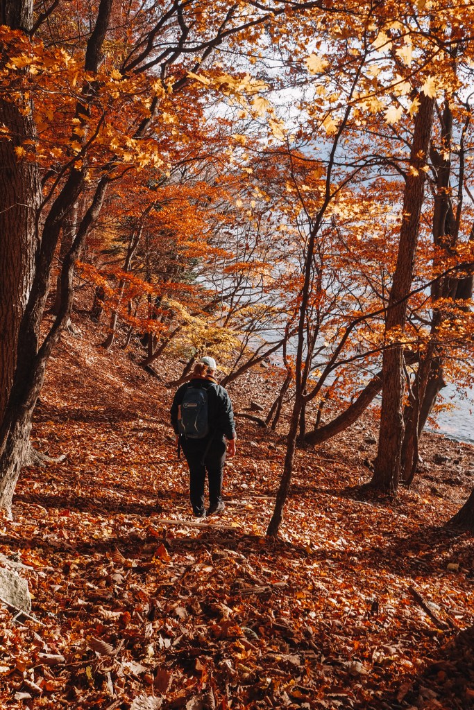
We started on the south side and parked our car in the closest carpark to the trail head, next to the lake and began our hike at about 6:30am. The south trail begins very gently with little inclines over small hills and follows the lake the entire way. Because we were there late in autumn, a lot of the trees were bare which meant we had great views of the lake the whole way. As you get deeper into the trail it becomes more precarious with small, rickety wooden bridges that cross over valleys and thin trails where you need to watch your step in autumn because there are a lot of hidden rocks and tree roots to trip over. Georgia only fell over once in 9 hours though, so it’s not really dangerous or anything, just be wary. Some of the infrastructure on the south trail was damaged but it was ok for us because the streams were all dry when we went. Hopefully it is mended before summertime, but make sure you have proper hiking boots just in case.
A surprise for us was that we only came across 2 other people on the trail. However, the joy of being the only people on the trail for miles was that we could enjoy the spectacular scenery all to ourselves. The fallen leaves were like a blanket on the ground and we occasionally passed through sections of evergreen trees where the environment was very different. Along the entire route the lake kept us company with some spectacular viewpoint stop offs to admire the never-ending lake.
Without any method of measuring distance we couldn’t tell you how far the south shore trail is, but it took us 6 hours to reach the ‘half way point’ which was the time we thought it would take us to do the whole thing. Man were we wrong!
At the ‘half way point’ we finally saw some people after seeing only 2 people in the first 6 hours. There is also a bus stop that is a few hundred metres down the only road away from the lake. At the bus stop there are the only toilets on the trail as well. This bus will take you back to the town if you don’t want to continue. We stopped here for some lunch on the beach by the lake.
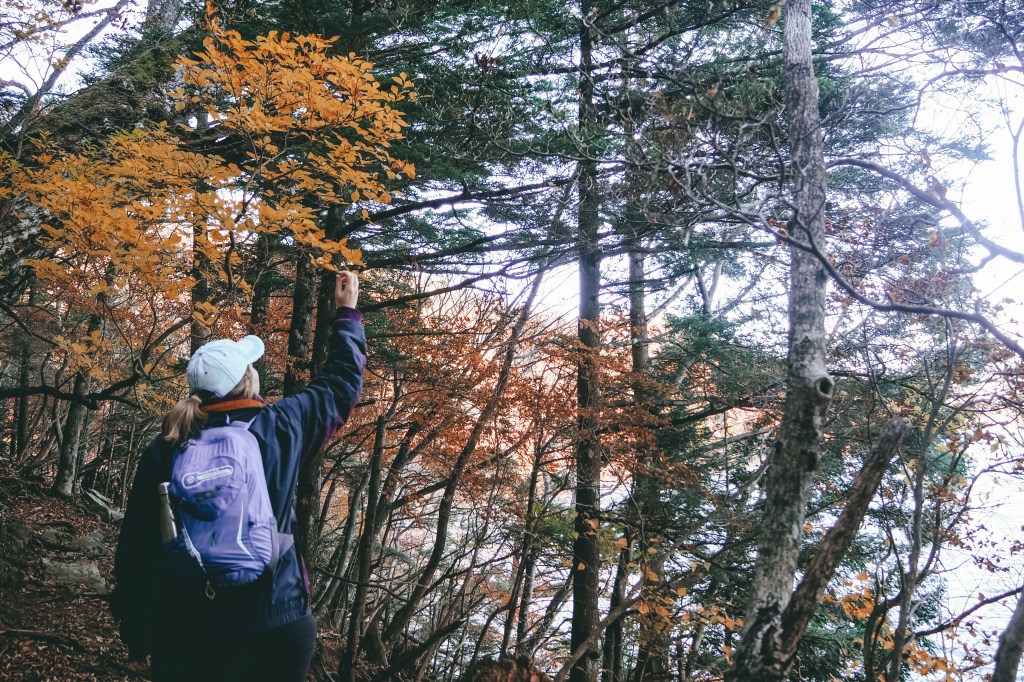
If you want to continue on, there’s good news. The northern trail is much easier, far more well-kept and shorter. The infrastructure on the northern side was newer and very sturdy and a lot of the trail had fences to stop you sliding into the lake. The trail is also a lot wider on the northern side. This was where we saw a lot more hikers and the terrain was still very beautiful.
A little way into the northern trail you veer off away from the lake and hike the road up to the Ryuzu Falls. These falls are amazingly powerful and not to be missed. It is a very popular spot where you can admire the falls from the bridge or from one of the restaurants that have views of the falls. There are a heap of souvenir shops along with the restaurants where you can get local sweets. We stopped off for a second lunch of soba noodles as we hadn’t brought nearly enough food and still had quite a while to go. The noodles were made by a group of old Japanese ladies who were all chatting amongst themselves and were very kind. It was lovely to have a rest and watch the falls from the warmth of the restaurant.
After the falls it’s not too far back to the town. The trail from the falls follows the road back into town so it’s not quite as peaceful as the first half of the hike but we still came across some local monkeys on the trail. They were completely unbothered by us and just went about their business. It was such an incredible thing to witness.
Once back in town we had to walk back around the side of the lake to our car and we finished at 3:45pm, clocking in a 9.25 hrs of hiking. We were so exhausted but incredibly happy. It was such a beautiful hike and we experienced so much in just one day.

Hiking route options:
Option 1: Hike the circumference of the lake.
Option 2: Hike one side of the lake. Either take the bus to the halfway point and hike back towards town or hike to the halfway point and take the bus back to town.
Option 3: Hike a small section of trail and then turn around and return to the town. We would recommend hiking a section of the south trail as it’s less busy and more peaceful.


thank you for this post. It was really hard to find much information on hiking experiences around the lake.
LikeLiked by 1 person
Thanks so much Zoe. So glad you found this helpful! Hope you enjoy the hike! 😊
LikeLike